Karakoram Highway – An Overview of The National Highway 35
Have you ever been to one of the highest highways in the world? It’s a marvelous experience if you’ve had any. And specifically, traveling on the Karakoram Highway is a lifetime experience that every person should have once in their life.
Without any further delay, let’s talk about the Karakorum Highway. Karakorum Highway, abbreviated as KKH and known as Karakorum, is the highest international paved road in the world.
It connects Western China and Pakistan through the Khunjerab Pass and is heaven for those who love the scenic views of mountains. This highway amidst the mountain ranges is a perfect spot to catch a breath and enjoy the sights during the summer vacation!
The construction of this highway started in 1959 and was completed in 1979. Both sides of the road, i.e., the Chinese and Pakistani sides, were built respectively by their governments. Formerly, the Karakorum Highway was also called China-Pakistan Friendship Highway as it was an initiative to unite the two countries. The Karakorum Highway is also one of the most strategic highways as it provides a route to transport military supplies in case of any Indo-Pak war.
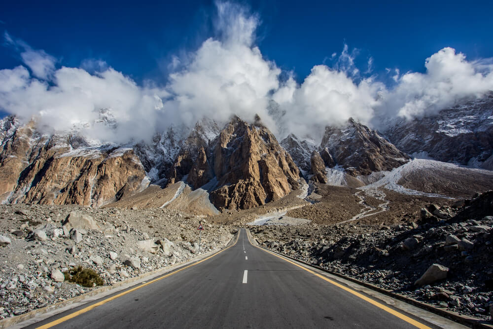
The total length of this highway is around 1300 kilometers, with Pakistan’s side being 887 kilometers long. The highest point of this highway is the Khunjerab Pass which is situated at an altitude of 4,693 meters.
Let’s get into more detail about this great highway, shall we?
Background of Karakoram Highway
Karakorum Highway was one of the few routes that crossed the Himalayas and the most westerly of them. If we look back at its history, it was a Caravan trail (a branch of the ancient silk road) between the Indian subcontinent and China.
Even before that, the route was under the Mongols and their great empire; they had named it the black range. It was later adopted by the Mughal empire, who ruled India for centuries.
The background of the Karakorum Highway is quite interesting as it’s part of the Silk Route. This historic trade route existed from the second century B.C to the 14th century A.D. Today’s highway was only part of the Silk route, a complete network of the Eurasian trade routes spread over 6,400 kilometers. It was essential to facilitating the economic, cultural, and political relations between the East and West.
The Karakorum Highway, also known as the Friendship highway, was constructed by Pakistani and Chinese engineers and workers in 1959. However, it took them almost 20 years to finish this great project.
Throughout its history, the Karakorum Highway has been influential not because it is the highest paved international road but because it passes through three massive mountain ranges worldwide and serves as an important trade route between the Indian Subcontinent and China.
Location – Starting & Ending Point of Karakoram Highway
The Karakoram Highway runs north of Pakistan and through some of the most breathtakingly beautiful landscapes. It starts from Hasan Abdal in the Punjab province of Pakistan and travels to Khunjerab pass in Gilgit Baltistan.
It is also one of the world’s highest-paved international roads. This highway route goes through some of the most breathtaking landscapes and tourist spots, such as Nanga Parbat, Hunza valley, Atabad Lake, etc.
Its 1300 km long highway links Kashgar in the western Xinjiang Uyghur Autonomous Region in China with the capital territory of Pakistan, Islamabad. The highway took 20 years to complete and extends for 800 km through some of Asia’s most rough and challenging routes.
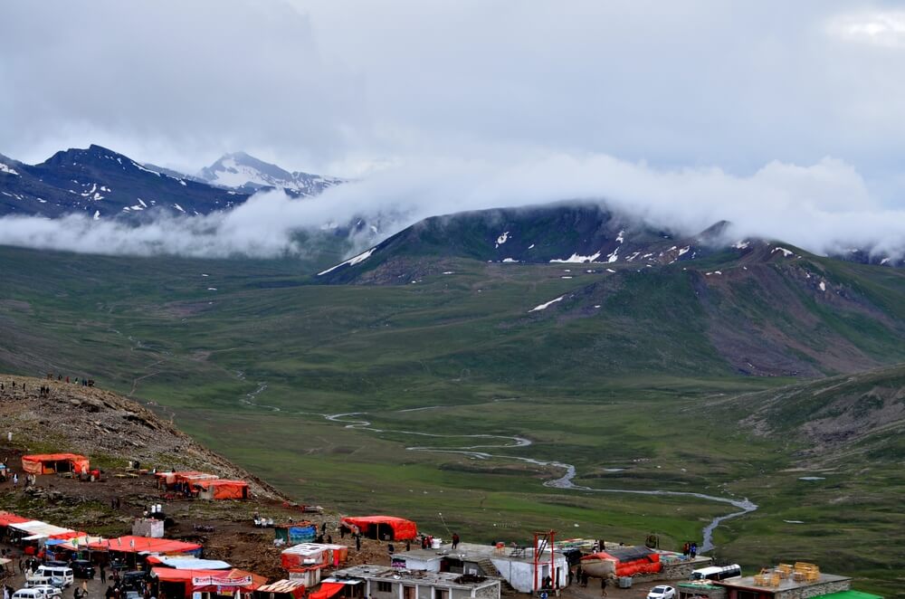
Karakorum Highway was a collaboration project between China and Pakistan, and it took almost 24,000 workers and much labor to complete this masterpiece.
The highway makes its way through the valleys starting from Kashgar through western Xinjiang; it passes near or around the sky-high peaks of the Sarykol Range at the meeting point of Pamirs or the Kunlun. Right after that, it crosses into the Gilgit Baltistan at Khunjerab Pass, which comes under Pakistani-administered Kashmir.
Karakoram Highway – Eighth Wonder of The World
Karakorum Highway is sometimes called ‘the eighth wonder of the world because of its engineering marvel and the fact that it runs through some of the most hostile terrains in the world. The Construction work on this highway started in 1959, and it took almost 20 years to complete by the end of 1979.
Karakorum Highway is considered a wonder also because it has the highest border in the world, the Khunjerab Pass. In addition, the highway is ranked as one of the best adventure tourism destinations as it provides stunning views of some of the massive mountains in the world, including K-2.
The highway starts from the Pakistani capital Islamabad and ends in the town of Kashgar in China. That’s an interesting fact to make it the world’s eighth wonder.
Another primary reason why the Karakorum Highway is called the Eighth wonder of the world is that the altitude of this highway near the Khunjerab pass hits almost 4700 meters and which makes it the world’s highest paved road.
What Is Special about Karakoram Highway?
Karakorum Highway has been a popular tourist spot for decades because it passes through three of the world’s most significant mountain ranges: the Karakorum, the Himalayas, and the Hindukush ranges.
Thus, the highway is one of the only places in the world where one can admire the beauty of a mountain like Nanga Parbat from the car’s window.
The second thing that makes it unique is that it has the highest border crossing between Pakistan and China. The highway connects the two countries at an altitude of 4,693 meters (15,397 feet), making it one of the highest-paved international roads in the world.
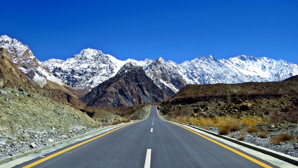
Lastly, the Karakorum Highway is one of the most rugged roads. Rock falls, landslides, and river crossings plague it. But, for many people, that makes it so appealing. Although constructing this highway was a task as there was a constant danger of landslides, the devoted governments and workers still made it possible. Even now, the maintenance of this highway is quite tricky, but the mesmerizing views make all the effort worthwhile.
The Karakoram highway was built in the 1960s by the Pakistani and Chinese governments as a joint venture. It was an ambitious project that took 20 years to complete.
Karakoram highway is a true world wonder and should be on everyone’s bucket list. The incredible views, the unique culture, and the friendly people make it an unforgettable experience.
Who Built Karakoram Highway?
The mighty project of the Karakorum Highway was a collaboration between the governments of Pakistan and China. The construction of this highway started in 1959 and ended in 1979 after 20 years of tiring work by Pakistani and Chinese workers. However, the construction didn’t stop in between; it continued amidst the mighty mountains with a danger of landslides.
When completed after 20 years, the project was open to the public in 1986. The inauguration ceremony of KKH was held in the same year and was named “Friendship Highway” by the then Prime Minister of Pakistan and Chairman of China.
The highway is named after the mountain range it crosses, the Karakoram. The range includes some of the enormous mountains in the world, including K2. The route links the Chinese autonomous regions of Xinjiang and Tibet with Pakistan.
The route through the Karakoram Mountains is one of the most challenging roads in the world. As a result, it has been nicknamed the “eighth wonder of the world.”
If you have yet to visit it, you’re missing out on an adventure worth doing, so pack your bags and drive on the Karakorum Highway for the most stunning views.
How Much Is the Height of Karakorum Highway?
Karakorum Highway is a famous tourist attraction that attracts tourists from all over the world and has the honor of being one of the highest paved roads in the world.
The highway is about 4700 meters above sea level at its highest point, Khunjerab pass, the border between Pakistan and China. It crosses through some of the world’s tallest mountains, including K2.
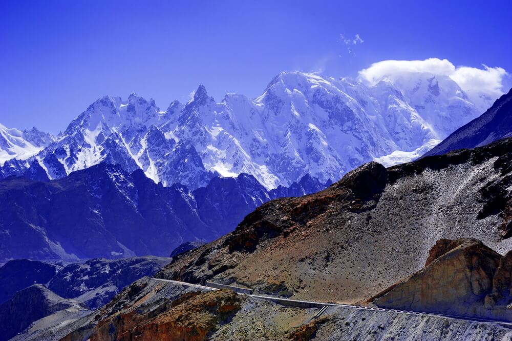
The construction of this highway started in 1959 by Pakistani and Chinese engineers, and it took about 20 years to complete. It is one of the most challenging roads to build because of its rugged terrain and weather conditions.
However, if you’ve concerns related to height sickness, you’ll be glad to know the ascent of this highway is very gradual. Therefore, you’ll not feel the travel sickness, but consuming fluids on your way to this mesmerizing journey is better.
One of the Highest Paved International Roads in The World
Karakoram Highway is the world’s highest paved international road. It reaches an elevation of 4,693 m (15,397 ft) at its highest point, making it one of the highest roads in the world.
The highway connects Pakistan and China through some of the world’s tallest mountains, including K2. The construction of the highway was a massive engineering feat, and it’s called the “Eighth Wonder of the World.”
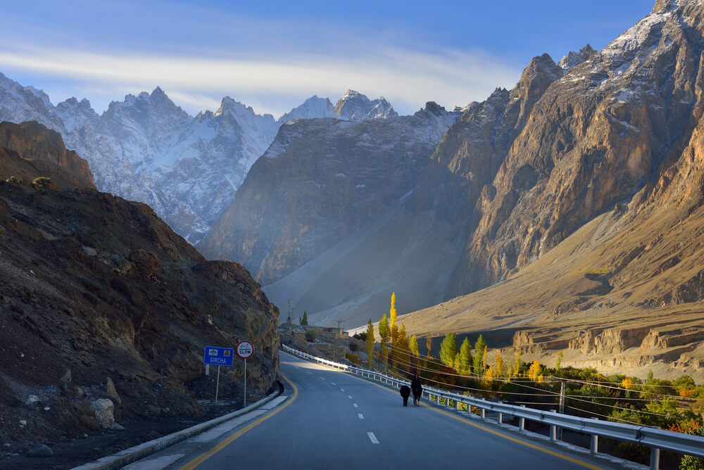
The highway provides stunning views of the Karakorum range and passes through mesmerizing valleys of Hunza and Nagar; traveling there is a once-in-a-lifetime experience.
View of Gilgit Baltistan’s Peaks & Amazing Glaciers
The highway is not only a way of strengthening ties between the two countries, but it also serves as a beautiful tourist spot where people can enjoy their vacation to the fullest.
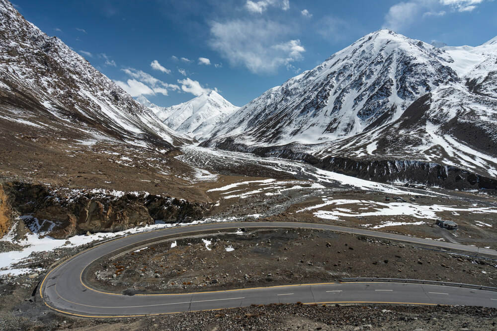
The Karakoram Highway offers breathtaking views of some of the world’s highest mountains, including K2, glaciers, forests, and meadows. That’s the only highway from where you can look at the beauty of the mighty Nanga Parbat.
The Karakorum Highway is the most epic road trip you can’t miss. Also, the massive mountains and the picture-perfect landscapes are a perfect reason to get on this journey with your friends or family.
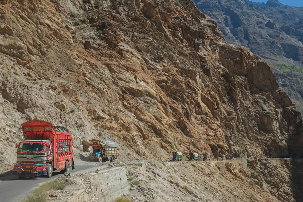
On your way toward the Khunjerab pass, you’ll pass through endless areas like valleys and regions worth seeing. A considerable number of ethnic and religious groups are residing in these valleys. You’ll get to meet the Punjabis in the center of Pakistan, the Ismailis in Hunza, and the Tajiks in Tashgurkan.
Once you get through the Khunjerab pass, you’ll be able to see the Xinjiang region of China. The valley’s people are so hospitable that you’ll feel at home.
Route to Reach Beautiful Tourist Spots
Traveling along the Karakorum Highway is considered one of the best road trip experiences in Pakistan and if you think it’s not true, try it yourself!
The highway is the route to many beautiful tourist spots in Pakistan, such as the Hunza Valley, Naltar Valley, and Fairy Meadows.
The starting point of the Karakorum Highway is Hasan Abdal, a historical city of Pakistan, and it will greet you on the journey of KKH. As you start your journey and keep traveling on the Karakorum Highway, you’ll see the beauty of Upper Punjab.
On your way upwards, you’ll come across the most mesmerizing natural views of beautiful spots. Finally, the highway will take you to the three highest mountain ranges in the world; you’ll be awe-struck to see Nanga Parbat (the killer mountain) from your car.
The 1300-km stretch of KKH between China and Pakistan has some of the most beautiful spots that deserve the attention of every tourist visiting Pakistan.
As you travel along the Karakorum Highway, you’ll see the breathtaking views of the Hunza River at some spots, so it’s good to stop and catch a breath with water in the view.
Karakorum Highway is the route to reach many beyond-beautiful spots; the mesmerizing beauty of Mansehra, Abbottabad, Pattan Besham, Thakot, Chilas, and Gilgit Baltistan will leave you awe-struck!
Traveling at high altitudes will make you feel hungry again and again; there are good local and desi spots where you can eat your heart out! Remember to pack enough snacks and fluids before you hit the road again.
Hundreds of truck drivers, traders, and tourists use the Karakorum Highway daily, so there are plenty of food and snack spots.
Rock Art & Petroglyphs Along Highway
Traveling to the northern side of the KKH while entering Gilgit Baltistan, there are the popular Buddhist archaeological spots between Darel and Tangir valleys, known as the Shatial Rock Art Carving/petroglyphs.
As KKH is a part of the ancient Silk route, this area was famous as the Old Silk Road. Here the Indus river links to the other valleys as a junction.
It is believed that these Stone carvings were left behind by the Sogdians, who were Persian people during 500-700 AD. They used to live in Central Asia and traded between Europe and China through the Silk Road.
The symbols and carvings on the rocks have different meanings. For example, some of them are animals that were considered sacred in that era.
The Sogdians used these symbols as a form of expression and communication. They carved them on the rocks to mark their journey, to show their presence, or to show ownership over a particular area.
These carvings are historical artifacts and a great source of information about the Soghdian culture.
The rocks along the Karakorum Highway are adorned with centuries-old rock art and petroglyphs. These carvings were made by the earliest inhabitants of this region and depict scenes from their everyday lives. Travelers, merchants, or pilgrims passing through central Asia used to carve their names and times on these rocks.
If you’re lucky, you might spot some ancient cave dwellings!
Heaven for Motorcyclists
The Karakorum Highway is a dream come true for motorcyclists. The winding roads, scenic views, and challenging terrain make it the perfect place to test your skills.
Just be careful not to push yourself too hard – the altitude can take its toll on even the most experienced riders.
The highway is the ultimate challenge for devoted motorcyclists looking for an adventure of a lifetime. There are organized bicycle tours every year that gives a chance to explore the highway and its surroundings in a safe and controlled environment.
Previously, there was a decline in travel to Pakistan because of the terrorist attacks, and there were not enough tourists to explore this region in such a way. But now Pakistani tourism is restoring its position, so it’s a great time to visit.
However, the border is not open to cyclists; if you want to cross the border, you’ll have to take the bus from Sost valley in Pakistan. It’s possible to cycle up to the pass but not across it.
Is it Safe to Travel the Karakoram Highway?
Despite its reputation as a dangerous road, the Karakorum Highway is safe. The Pakistani government has made a lot of effort to improve safety in recent years, and the number of accidents has decreased significantly.
The highway is generally safe to travel, but there are some risks you should know about. The most common dangers are rock slides and flooding, which can occur without warning.
There have also been reports of robberies and hijackings, so it’s essential to be aware of your surroundings and travel in groups if possible.
Overall, the Karakorum Highway is a safe and enjoyable way to experience the picturesque scenery.
Islamabad to Karakorum Highway Distance
The Pakistani part of the highway starts from Hasan Abdal, almost 50km northwest of Rawalpindi and around 60 km from Islamabad.
You can travel from Islamabad to Hasan Abdal, which is a 50-minute journey to get on the Karakorum Highway, and let’s get started with the adventure.
From Hasan Abdal, the distance to Hunza valley is around 544 km, and it would take you almost 12 hours of driving if you don’t stop for a break.
What Is The Importance of Karakorum Highway?
Karakorum Highway does not just connect two countries but also provides a connection between the people of both countries.
It is a symbol of peace and friendship between Pakistan and China.
The highway has played an essential role in the economic development of Pakistan and Gilgit Baltistan. It has also opened up new opportunities for trade and tourism between the two countries.
Karakorum Highway has been economically significant for the valleys like Nagar, Hunza, and Skardu, providing them access to better product markets.
The highway has also helped develop infrastructure and communication networks in these remote areas.
Frequently Asked Questions
Is the Karakorum Highway open for visitors?
Yes, the Karakorum Highway is open for visitors throughout the year. However, due to heavy snowfall in the upper reaches of the highway, it is advisable to travel between June and September.
The highway is open for travelers all year except the Khunjerab pass, which opens only between 1 May and 31 December.
Who owns the Karakoram Highway?
Pakistan and China jointly own the Karakoram highway. The two countries have been collaborating on developing and maintaining the highway since 1978.
Is the Karakoram highway a Silk Route?
No, the Karakoram highway is not a silk route. It’s only part of the ancient silk route, a network of trade routes connecting the East and the West. The traders used it for the trade of silk and other goods.
What is the previous name of Karakoram Highway?
The old name of the Karakoram highway was Silk road, as it was a part of the Silk route. However, the Karakoram highway got renamed in 1959 as its construction started.
The other official names of the Karakorum Highway are N-35 or National Highway 35 in Pakistan and China National Highway in China.
Is the Karakoram Highway Worth it?
The Karakoram Highway is a spectacular engineering achievement and a beautiful drive. It is worth it for the scenery and the experience. However, it is not an easy road and can be dangerous in certain sections, so you need to be prepared for that.
How many people died on Karakoram Highway?
There is no accurate count, but it is estimated that over 1,000 people have died on the Karakoram Highway. Most of these deaths are due to accidents during highway construction, but some are also due to avalanches and other natural disasters.
The Karakoram Highway is an incredible work of engineering and a beautiful drive. However, it is worth doing if you are prepared for the challenges. The Karakorum Highway tour is a must in every adventurer’s life. It’s a marvelous experience that you’ll never forget. So gear up and get on an adventure this summer!
